At Lithuanian Monuments
Intro. This project is an improvement on a previous Intangible Cultural Heritage Preservation Territorial Planning Document. The need to update the document arised due to public concern regarding the ongoing development of the site.
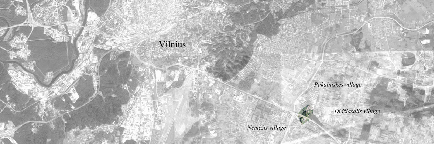
About Nemėžis estate. Nemėžis estate and park is one of the oldest complexes in Vilnius outskirts. It is mentioned in historical resources back to the 14th century. The estate had economic, political and cultural relevance due to its proximity to Vilnius city center (7 km - 4.3 mi), and the nearby route connecting Vilnius to Ašmena. Existing Nemėžis estate with its brickwork buildings and a park was built in the 19th century under the rule of Tiškevičiai family. Before this, the site is connected to many historical figures - Vytautas the Great, one of the most famous rulers of the Grand Duchy of Lithuania, Radvilos, Sapiegos, Chodkevičiai, Oginskiai, Tiškevičiai, Bochvicai families.
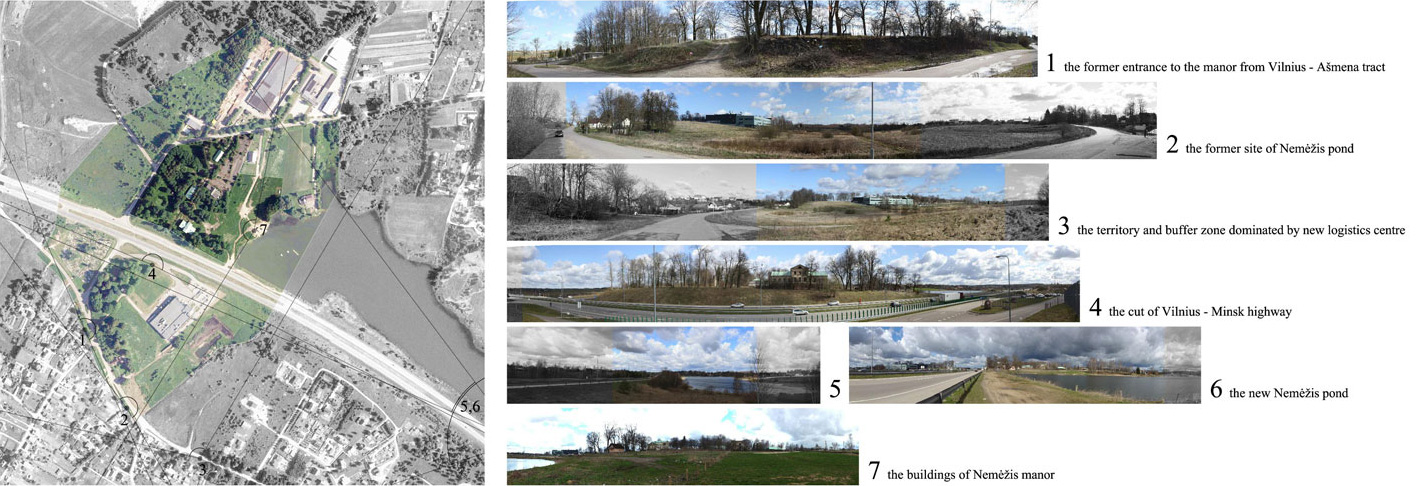
The estate's territory and its surroundings have changed comparing to the time of Tiškevičiai ruling. Although main buildings of the estate have remained, the territory of the park was split in two by the Vilnius - Minsk highway in the second half of the 20th century. The present location of the Nemėžis reservoir was formed in the second half of the 20th century as well.
Historical photos reflect estate life in the interwar period. The first picture is taken from the estate entrance road to the palace.
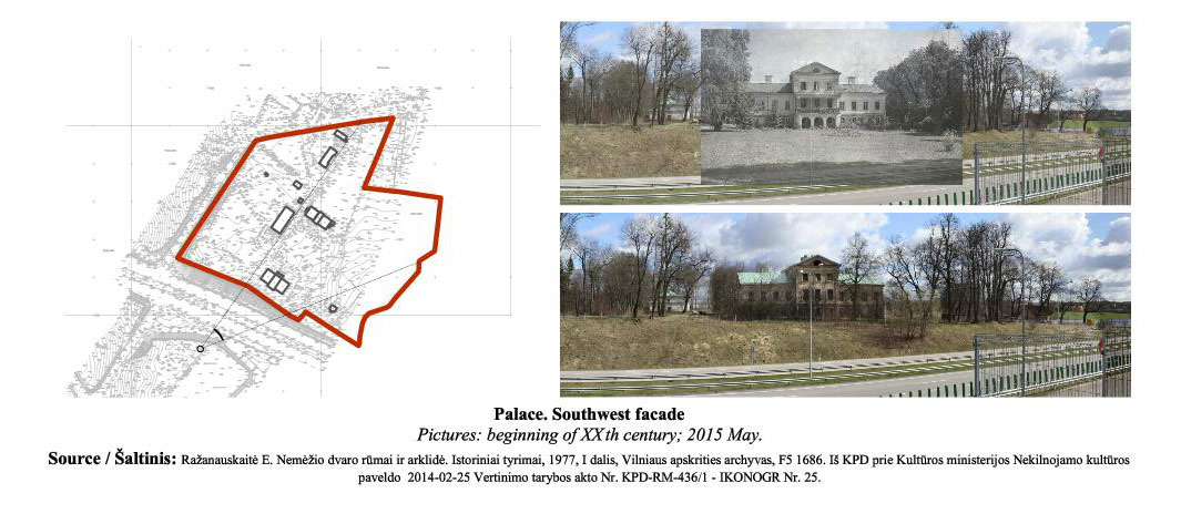
The next two pictures depict the portal of the palace and part of the main yard.
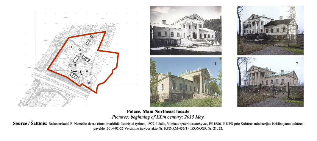
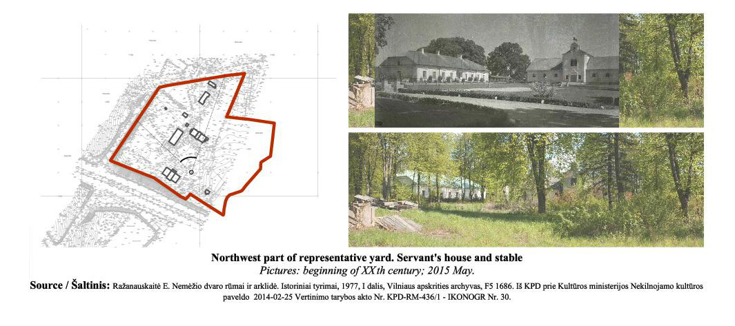
The last picture casts the main yard with the servants' house and the stable in the background.
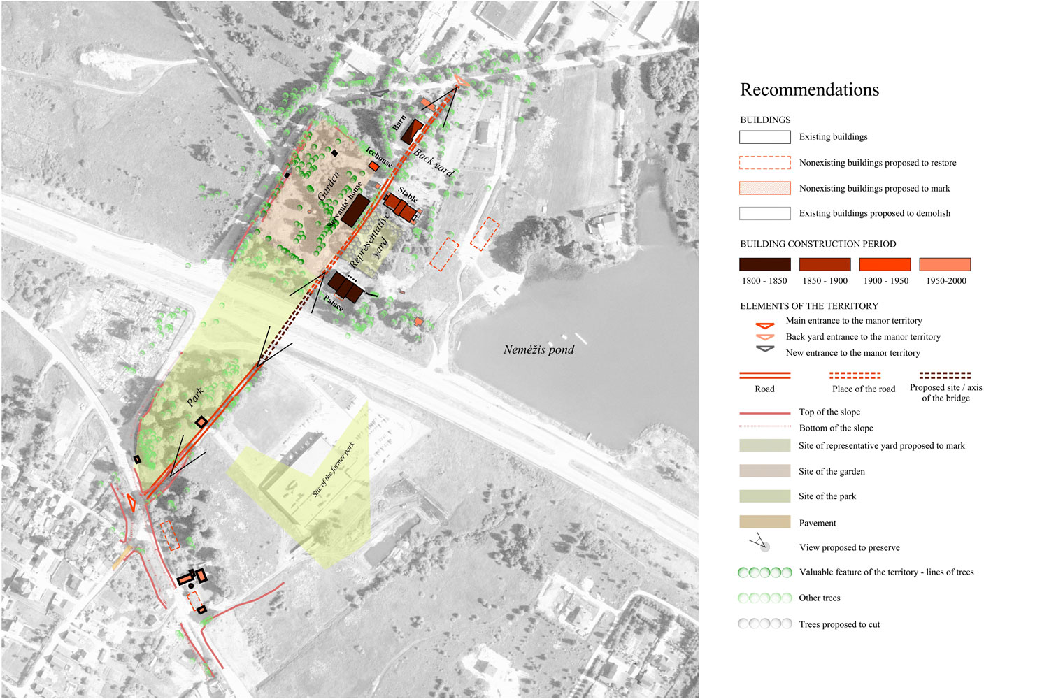
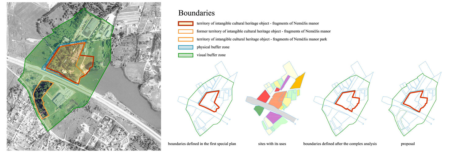
Challenges. The boundaries of Nemėžis estate are conditional since its environment was changing: buildings and park don't compose a unified complex because of the highway and reconstruction of the dam.
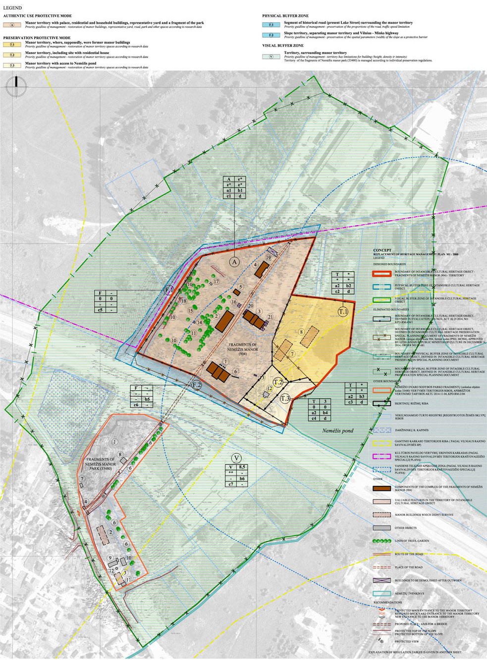
The environment of the estate has changed but the spatial structure elements such as territorial boundaries - streets and roads (Lake street, Old Road Street), alley, connecting the entrance to the main yard and the backyard entrance, remained. The relief didn't change significantly, except invasive highway construction, there are ridges of relief marking different zones of the estate territory.
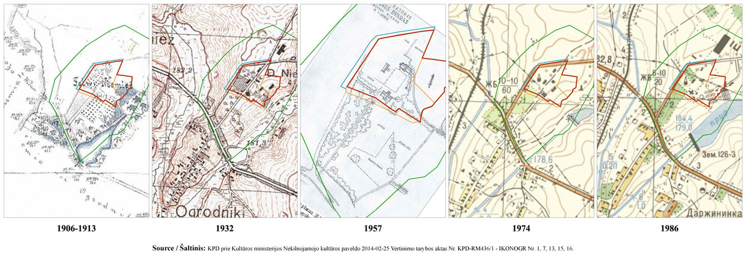
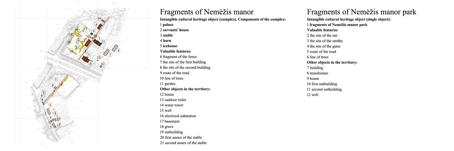
Written historical resources and historical maps indicate there were more components of the estate whose locations aren't identified. In order to ensure the preservation of the existing integrity of the site and with the intention to get more information about the original estate structure, the valuable features (defined after implementation of a historical survey) of the territory were respecified.
The process. The goal of the planning document is to ensure the preservation of the historic remains and the territory of Nemėžis estate. It does so by specifying the boundaries of the territory of the object and its buffer zone as well as heritage preservation requirements.
The boundaries of the territory, approved in the previous special planning document, were changed according to the new survey.
Main preservation requirements were defined in the concept: land work, building, building heights, volume characteristics, density, intensity, finish materials, greenery characteristics.
My contribution. Performed historic and present condition survey, took part in the decision-making process for the statements of concepts.
Together with the project architect Giedrė Filipavičienė, I visited the site and created photographic documentation of the present situation. Surveyed the territory of Nemėžis estate including its history, historic maps, territorial planning documents. I also executed the graphical and written parts of the project.