At Lithuanian Monuments
Intro. Two Individual projects for Klaipėda's Old Town and New Town were executed in parallel, with the New Town following the Old Town. The aim of Intangible Cultural Heritage Preservation Territorial Planning Documents is to ensure the preservation of Cultural Heritage Sites, legitimization of the heritage preservation requirements in their territories and buffer zones.
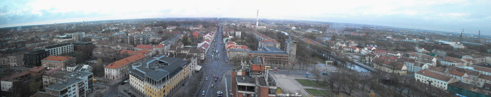
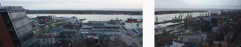
About Klaipėda. Klaipėda, or Memel in German, is a city with distinctive history, which started in the middle of the 13th century. From a fishing village, it grew to a city with fortification system, set up by Crusaders, later on - a port. At certain times it was home for German, Lithuanian, Jewish, Irish and Dutch communities.
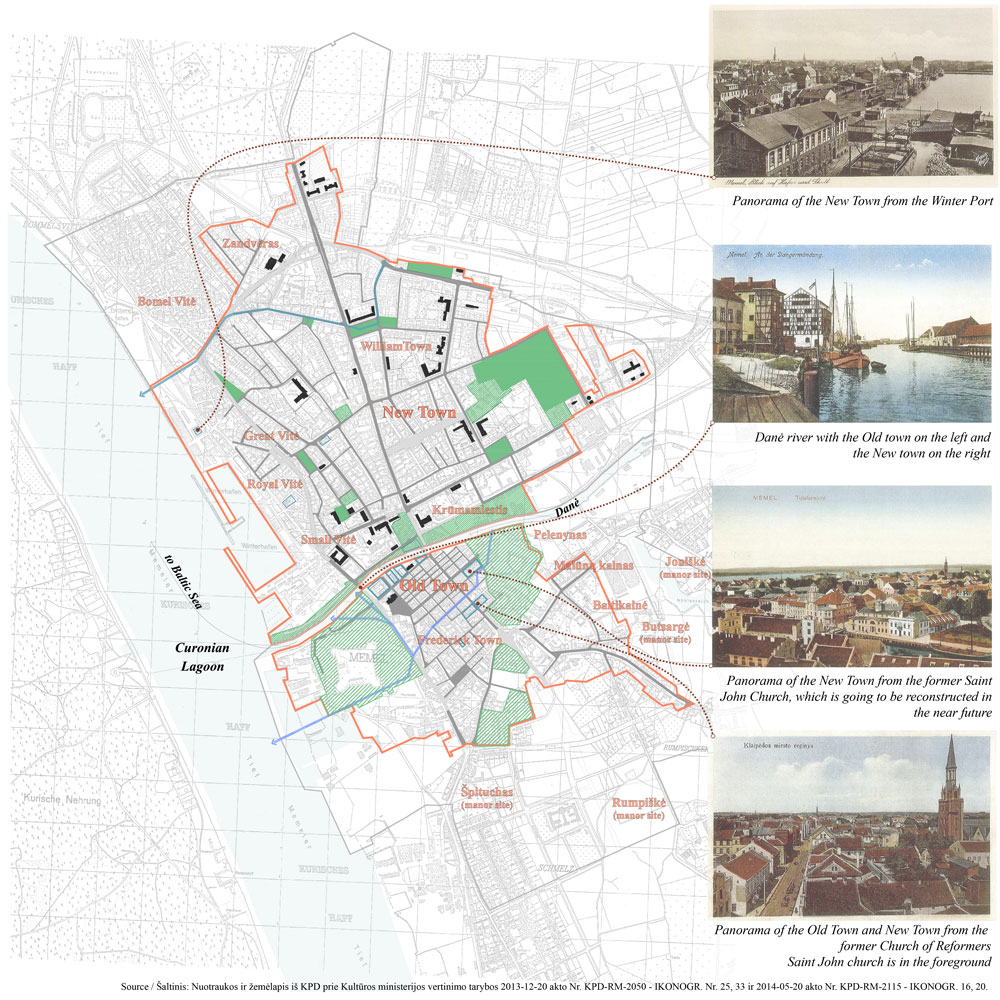
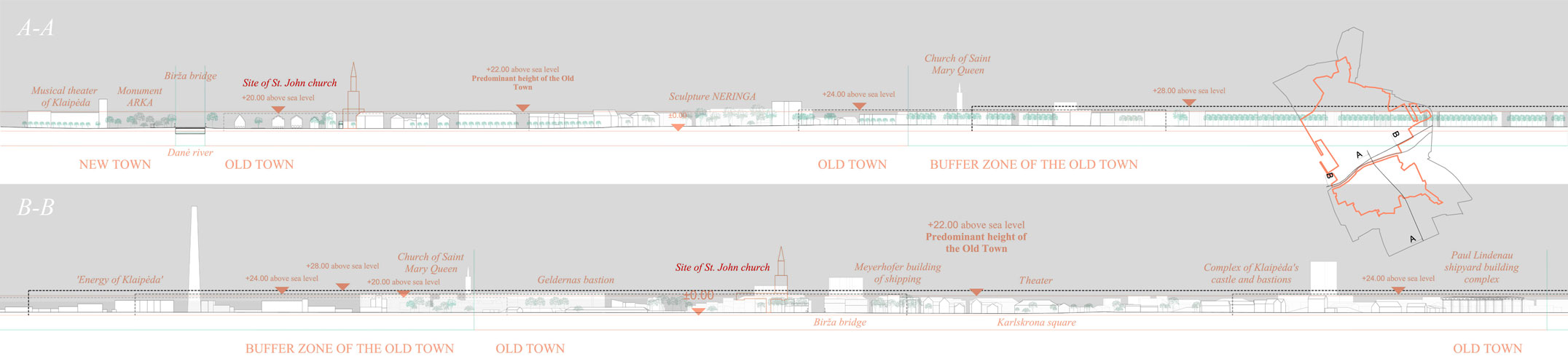
In the 13th century, the castle was built on the island on the west side of Danė river and a town on another island nearby. In the 15th century, the town was replanned according to the structure of Ancient Roman Cities and military camps with two main streets - cardo and decumanus - Market Street, connecting the castle with churches, and perpendicular Bridge Street, leading to other towns. In the middle of the 15th century, the city became an important port. Its skyline was rich with the silhouettes of the multiple places of worship.
Klaipėda survived several fires and was rebuilt according to the former plan structure. The decisive time for Klaipėda occured after World War II, when it lost many of its residents and a large number of buildings were in ruins. Its churches and other important landmarks were demolished rather than restored. The historic city was rebuilt in a new manner.
Klaipėda has German timber framing, Historicism, Modernism, Soviet and Contemporary architecture. All of them mark different periods in the city's development and reveal Klaipėda's sense of place.
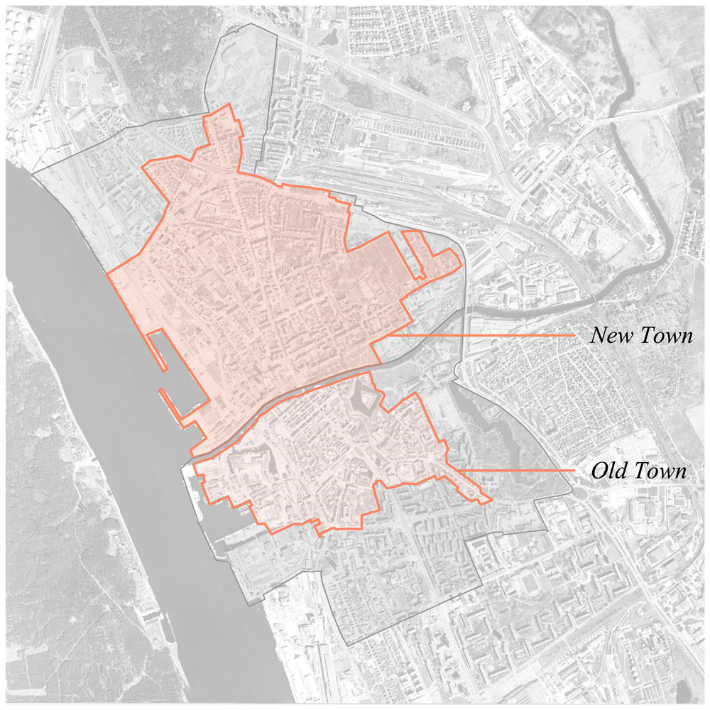
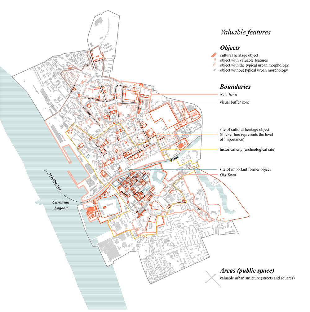
Challenges. The city did not have heritage preservation plans for its historical territories yet. It is problematic because of running infill development in the Cultural Heritage Sites and a pressure of high-rise development in visual buffer zones. The Old Town and the New Town had boundaries for their territories and buffer zones approved in 2012. These projects are the continuous work to ensure the preservation of the Old Town and the New Town of Klaipėda with their distinctive characteristics.
The process. In the concept stage, the structure and principles for the regulations were set taking into account valuable features of the territory (urban morphology, valuable streets and squares, landmarks, views, status of buildings). These were defined by the institution implementing research of the territory, and our own historic and present condition survey.
The concepts of the projects were modified several times after presenting it to the local representatives of Cultural Heritage Department, community members, preservationists and local architects.
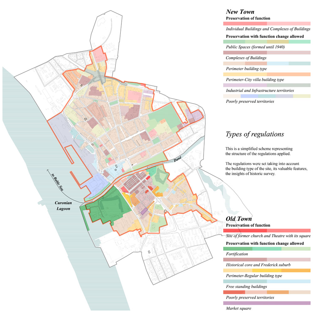
In the final documents, every site of the territories was analyzed defining the requirements for its use regarding historic preservation. The requirements for the territories include land work, building, building height, volume characteristic, density, intensity, finish materials, greenery characteristics.
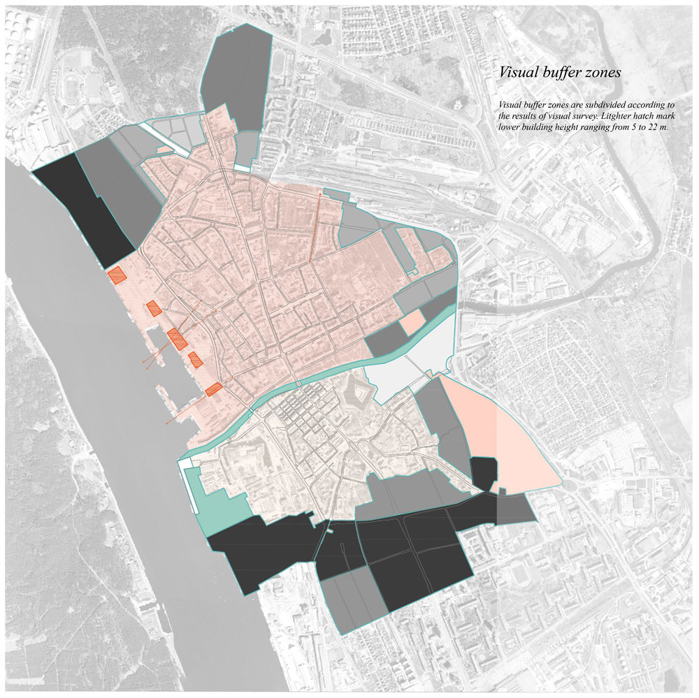
Visual buffer zones were subdivided according to the results of a visual survey. The aim was to preserve the low-rise building sense of the historic city when arriving from major routes, observing from buildings or cruise ships.
My contribution. Contributed to all the stages of the projects: performed historic and present condition survey, took part in the decision-making process for the statements of concepts and final documents, presented the projects to the community.
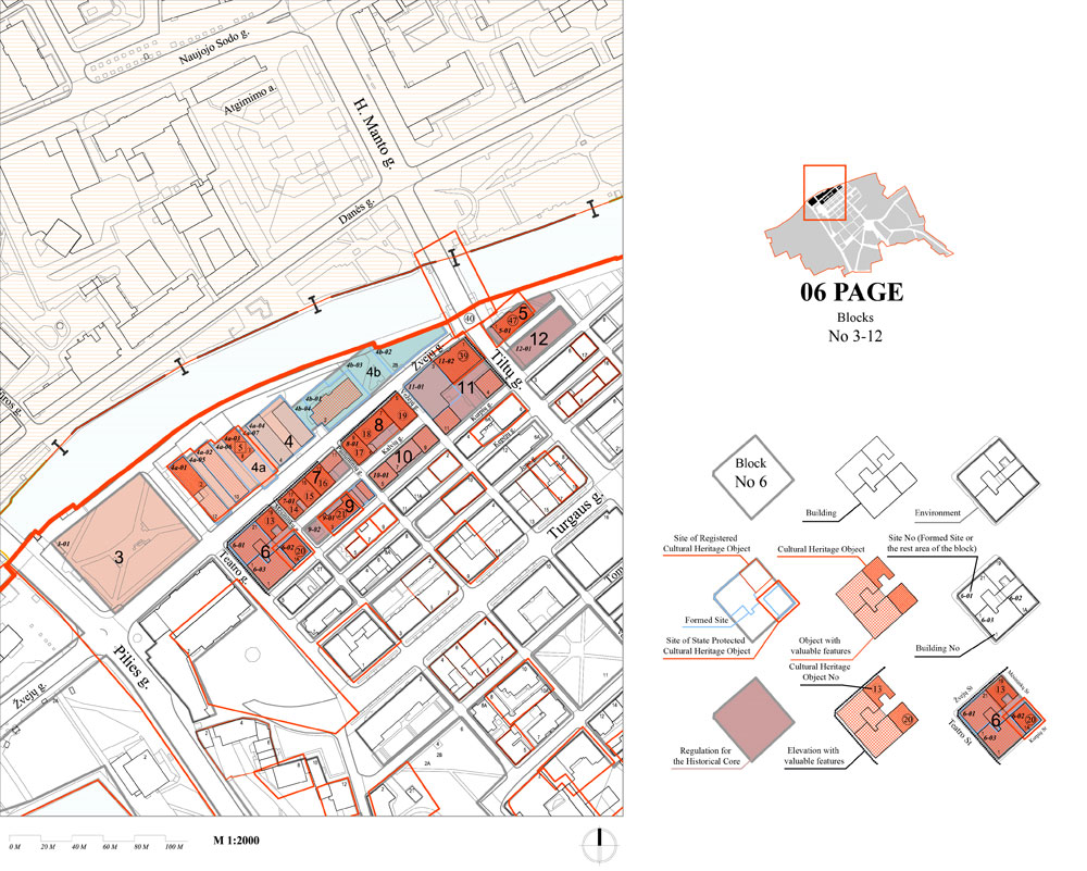
In the survey stage prepared architectural-urban survey of historic districts which included survey of city development stages, city street net evolution, distribution and origin of historic public spaces and parks, cartogram of building construction time and alterations (which was carried out after studying historical resources, discussions with the local representatives, within the work group, visual survey in situ), defined semantic elements of historic districts and formulated the conclusion of the survey. My work was discussed in regular meetings within the work group.
Also analyzed the approved territorial planning documents, documented cultural heritage objects, was the main draftswoman of the graphical part of the projects and author of certain parts of the explanatory note.
Being an assistant of the project architect since the beginning and throughout different stages of the projects, I got acquainted with the process of the design of this type of documents. As time went by I got progressively more involved in the decision making process.